
 Yahoo News
 Pre-Thanksgiving storm may create travel chaos for central, eastern US


Turkeys are being purchased and bags are being packed as Americans gear up for the Thanksgiving holiday, which is less than a week away. AccuWeather meteorologists say that a large storm will cause a myriad of weather hazards that can lead to further congestion on the road and in the air in parts of the country.
According to AAA, 55.4 million travelers will be venturing at least 50 miles from home for Thanksgiving, which would be an increase of 2.3 percent over last year.
 |
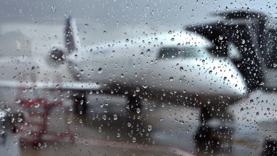
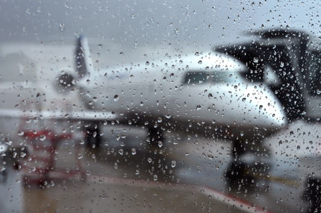
A rain-covered window obscures the view through a terminal window of an United Express passenger plane at a gate at Denver International Airport in Denver, Colorado. (Photo by Robert Alexander/Getty Images) |
"As millions of Americans plan to hit the roads and airports ahead of the Thanksgiving holiday, a potent storm is expected to bring a myriad of impactful weather to the central and eastern United States," AccuWeather Meteorologist Brandon Buckingham said.
Read on below for a breakdown of where the storm will dish up the worst weather ahead of the holiday.
Wet conditions and road spray will add to slowdowns on the highways across the southern tier of the country as rain and thunderstorms sweep eastward from Sunday through Tuesday, AccuWeather forecasters say.
Cities such as Oklahoma City will be first in line for the stormy weather late in the weekend, before the threat shifts eastward along the Interstate 20 and I-10 corridors early this week, reaching the major airport hub of Atlanta on Tuesday.
 |
For some of these locations, this will be the first risk of severe thunderstorms since September.
"While some of this rain will be beneficial in drought-stricken places like Louisiana, the Tennessee Valley and into the southern Appalachians [this] week, the risk of minor flooding and numerous travel delays will also accompany the stormy weather," Buckingham said.
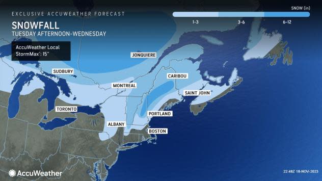
Wet days have been few and far between so far this month across the Northeast. This week, inclement weather will arrive at the most inopportune time. Rain and wind will likely cause the biggest disruptions to air traffic and travel along the I-95 corridor from Washington, D.C., to Boston during some of the busiest travel days of the year -- the Tuesday and Wednesday preceding Thanksgiving.
"Many places in the Northeast have had a very dry November so far. As of Saturday morning, Philadelphia and New York City have had a total of only 0.07 of an inch of rain the entire month. In one fell swoop, a lot of places will be bumped out of the top 10 list for the driest Novembers on record [this] week with a major storm that will bring a soaking rain to the region," AccuWeather Senior Meteorologist David Dombek said.
 |
"Expect some flooding of poor drainage areas as well as ponding of water on streets and highways. This would have an impact on travel even in a normal situation, but with pre-holiday travel volume picking up on Tuesday and Tuesday night, this will certainly have an even greater impact," Dombek said.
In the New York City area, the greatest impacts will be Tuesday night into early Wednesday, while in much of New England, the worst weather will occur Wednesday morning. According to AAA, 2:00 to 6:00 p.m. local time on Wednesday is the worst time to travel for the holiday.
Across the interior, there may be enough cold air at the onset of precipitation for conditions to become slippery for a time late Tuesday into Wednesday with a mixture of ice and snow. This risk will be greatest from northeastern Pennsylvania to northern New England.
 |
As the major storm system strengthens on its path across the eastern third of the country, gusty winds will whip throughout the Great Lakes, Ohio Valley and Northeast, resulting in bumpier flights and hazardous crosswinds for motorists. Wind gusts can reach 30 to 40 mph and perhaps as high as 50 mph.
Behind the storm, much colder air is expected to arrive, but it may be delayed a bit and not arrive right on time for Thanksgiving, forecasters say.
It is possible that it takes until the last weekend of November for the full thrust of cold air to dive into the Northeastern states and trigger rounds of lake-effect snow showers and squalls. The chance for a sizable lake-effect snow event prior to and during the Thanksgiving holiday was beginning to diminish on Saturday as AccuWeather meteorologists analyzed the latest weather data.
The delayed arrival of cold air may not diminish impacts to travel, however, should lake-effect snow begin to ramp up during the busy post-Thanksgiving travel days.
This can be a concerning setup for holiday travelers given that the risk for lake-effect snow showers and squalls is poorly timed with the peak of Thanksgiving travel, according to AccuWeather Chief Meteorologist Jon Porter.
"We recommend people check back frequently with the AccuWeather forecast over the coming days, especially if they have any travel plans around the Thanksgiving holiday near the Great Lakes," Porter said.
 |
Thanksgiving Day itself is expected to be largely dry and cool across the Northeast, including the big East Coast cities, according to Dombek.
"Regarding the Thanksgiving Day parades scheduled for New York City and Philadelphia, the wind situation does not look too bad," Dombek said.
AccuWeather's expert team of meteorologists will be closely monitoring the weather trends for the days after the holiday to give travelers the most advance notice of potentially adverse conditions for the trip home. A brewing storm was already on their radar at the end of this past week, which may spread rain and snow from the Rockies to the Northeast during the last weekend of November.
Want next-level safety, ad-free? Unlock advanced, hyperlocal severe weather alerts when you subscribe to Premium+ on the AccuWeather app. AccuWeather Alerts™ are prompted by our expert meteorologists who monitor and analyze dangerous weather risks 24/7 to keep you and your family safer.
