Scientists say storms like Ciarán are becoming ‘more damaging’
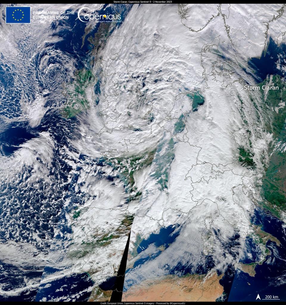
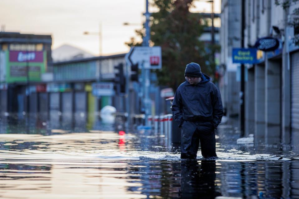
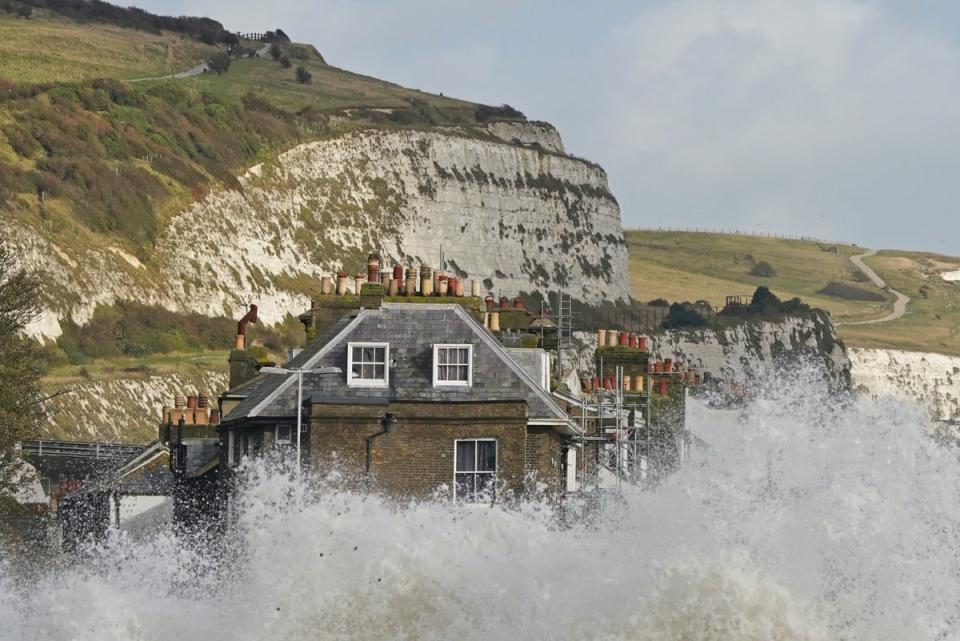
Storm Ciarán battered the UK with heavy rains and powerful winds this week, prompting hundreds of weather and flood warnings, evacuations, school closures and travel chaos.
The stormrapidly intensified on Wednesday to become one of the strongest ever recorded in western Europe. The UK Met Office said the mean sea level pressure reading for England and Wales in November is the lowest ever - breaking a record which had stood since 1916.
At least seven people were killed and dozens injured across Europe with widespread damage and flooding reported in the UK.
Follow our live coverage of Storm Ciaran here.
“It looks like a once-in-every-few-years storm for the UK and France,” said Bob Henson, a meteorologist and science writer with Yale Climate Connections, adding that it could turn into “a once-in-a-generation storm”.
Ciarán arrived hot on the heels of Storm Babet which left large parts of Northern England and Scotland flooded last month.
The storm was driven by a powerful jet stream that swept in from the Atlantic, the Met Office said this week. While storms during autumn are fairly normal for the UK, experts say such events are now “more damaging” due to the impacts of the climate crisis.
“There are a lot of attribution studies and other lines of evidence showing that autumn/winter storms like this are more damaging because of climate change,” Dr Friederike Otto, senior lecturer in climate science at Imperial College London, said.

“That’s because the rainfall associated with these types of storms is more severe due to climate change, and the storm surges are higher and thus more damaging due to the higher sea levels.”
Storm-related rainfall has intensified in recent years, according to the Met Office. Ciaran lashed the UK with up to three inches of rain and over 100mph winds.
“There is evidence that more rainfall is resulting from these storms,” Dr Melissa Lazenby, lecturer in climate change at the University of Sussex, said.
“It is also very likely that the intensity of these winter storms will increase, and that rainfall from these events will result in larger impacts such as flooding and larger storm surges alongside the coastal regions.”
The Met Office says that in the future, the last three months of the year will likely see more days with rainfall totals over two inches.

The connection between high winds and the climate crisis is less clear, experts say. But increased global temperatures have been leading to more rainfall around the world.
This is because hotter air holds more moisture, explains Dr Michael Byrne, from the University of St Andrews.
“The heavy rain is very likely to be linked to climate change: a warmer atmosphere holds more water vapour, so when it rains it rains more,” he said.
“The link between strong winds and these type of storms and climate change is very much up for debate.”
“There is some research suggesting that sting jets, which are very strong gusts of wind, essentially in these types of storms, may become stronger and more frequent as the climate warms,” he added, but that research was in its early stages.

Scientists say the UK needs to be better prepared to deal with these storms as the world continues to warm. The flooding comes just weeks after the UK experienced the hottest September, and before that the hottest June on record.
“As records tumble, the increasing frequency and severity of extreme events is a stark reminder that the impacts of climate change are not a future probability, but a present threat affecting us in all parts of the world,” Dr Rihab Khalid, Isaac Newton Trust Research Fellow at the University of Cambridge, said.
“It is all too apparent that we are not yet prepared for the impacts of climate change.”
“Slowing progress to net zero now will only mean more extreme weather and greater threats like this in the future,” she said, referring to the UK government’s recent decision to rollback key green targets.
The increasingly extreme weather driven by the climate crisis is a key agenda item at next month’s Cop28 climate summit.
“Just weeks from the next UN climate summit, extreme weather won’t let our political leaders forget what is at stake,” Gareth Redmond-King, Head of International Programme at the Energy and Climate Intelligence Unit (ECIU), said.
“At 1.2C of warming, the fingerprints of climate change are increasingly detectable on many forms of extreme weather; and the return of El Niño is only adding more heat,” he adds.

 Yahoo News
