
 Yahoo News
 Storm Caroline will hit the north of the UK this week bringing 80mph winds and snow


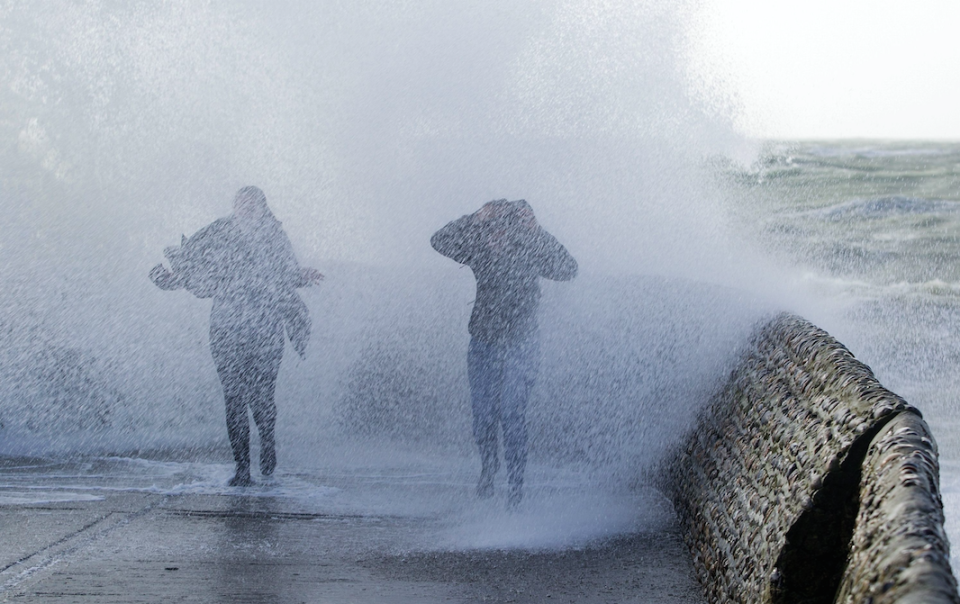
Winds of up to 80mph are expected as Storm Caroline hits the north of Britain later this week.
A severe weather warning has been issued by the Met Office for northern Scotland on Thursday.
Snow and falling temperatures are also expected to affect the west of the country on Friday as Storm Caroline, the third named storm of the season, passes through.
A Met Office statement said: ‘Storm Caroline is expected to bring a spell of very windy weather to northern Scotland on Thursday.
#StormCaroline has been officially named by the Met Office. High winds are expected to affect northern Scotland on Thursday. Warnings issued, stay #weatheraware pic.twitter.com/J7nZOEFhYr
— Met Office (@metoffice) December 5, 2017
‘Gusts of 60-70mph are expected quite widely, with gusts to 80mph possible near north-facing mainland coasts and across the isles.
‘Road, rail, air and ferry services may be affected, with longer journey times and cancellations possible. Some short-term loss of power and other services is possible.
Most popular on Yahoo News UK
Police hunt thugs who ‘strangled’ teenager and ‘forced him to apologise for being gay’
Britain braced for hail, snow and rain as Arctic winds hit and temperatures fall
Britain First supporter gave Nazi salute and shouted ‘white power’ before driving at Muslim curry house owner
Airline crew say they saw North Korean missile from their plane
Shocking video shows how sleeping driver ploughed his lorry into motorway traffic
‘It is likely that some coastal routes, sea fronts and coastal communities will be affected by spray and/or large waves.’
A yellow snow and ice warning is in place for Friday for Scotland, Northern Ireland, western England and Wales.
Forecasters said that some gusts could be strong enough to bring down power cables.
Areas outside the warning zone are also likely to experience windy conditions on Thursday.
Met Office spokeswoman Nicola Maxey said: ‘Outside of that area winds will pick up across the rest of the country so it will be a blustery day for many areas.’
As the storm moves away towards Scandinavia it will be followed by cold air on Friday which could bring snow.
Snow showers are expected to become increasingly frequent over northern Scotland late on Thursday and are expected across many other parts of Scotland, Northern Ireland, Wales and western England on Friday.

Forecasters said that 2-5cm of snow is likely for some areas, with 10-20cm possible over high ground.
Met Office chief meteorologist Steve Ramsdale said: ‘The strongest winds will reach the northwest of Scotland early on Thursday, extending to Northeast Scotland and the Northern Isles in the afternoon. During Thursday winds will start to ease in the west with the strongest of the winds becoming confined to the Northern Isles in the evening.
‘With the return of air from a northwesterly direction – with its origins in the Arctic – snow showers will become increasingly frequent and heavy across northern Scotland during Thursday evening.
‘Our warning shows that 2-5 cm of snow is likely for some, with 10-20 cm possible over high ground, mainly Scotland, Northern Ireland and Wales.
‘Icy surfaces are also likely to be an additional hazard, especially overnight and during the morning. Strong northwest winds may cause drifting of the snow in places with blizzard conditions possible at times across northern Scotland.
The heaviest and most frequent of the snow showers will progressively become confined to northeast Scotland during Saturday.’

