
 Yahoo News
 Sunny days ahead for Northeast, but not for long


Following a wet and stormy stretch of weather last week across the Northeast, Mother Nature will continue to bring about a stretch of dry weather that will last into Sunday for some, AccuWeather meteorologists are happy to announce.
"An expansive area of high pressure across the Appalachians and much of the Eastern Seaboard brought a good deal of sunshine both on Friday and Saturday," AccuWeather Meteorologist Brandon Buckingham said.
The air that settled in brought good drying conditions for working the soil, painting and other outdoor projects that may have been put on hold due to the pesky showers and thunderstorms of late.
Daytime temperatures at midweek were 10-15 degrees below the historical average, but some sunshine will allow temperatures to climb 5-10 degrees above the norm closer to the coast on Sunday. Even beach and pool enthusiasts can get some time in.
Typical highs in late May and early June range from the upper 60s over the northern tier to the low 80s along the southern Appalachians and around the large bays and sounds from Virginia to North Carolina.
For example, in New York City, temperatures rebounded to the mid-70s on Friday and then rose to the 80s by Saturday afternoon. Sunday's high temperature will depend on the strength of a breeze from the Atlantic and the return of clouds.
"Temperatures quickly rose by early Saturday afternoon across the interior Northeast, becoming comfortably mild for many," explained Buckingham.
 |
AccuWeather meteorologists are tracking the next rainmaker that will have some people in the Northeast reaching for raincoats and umbrellas.
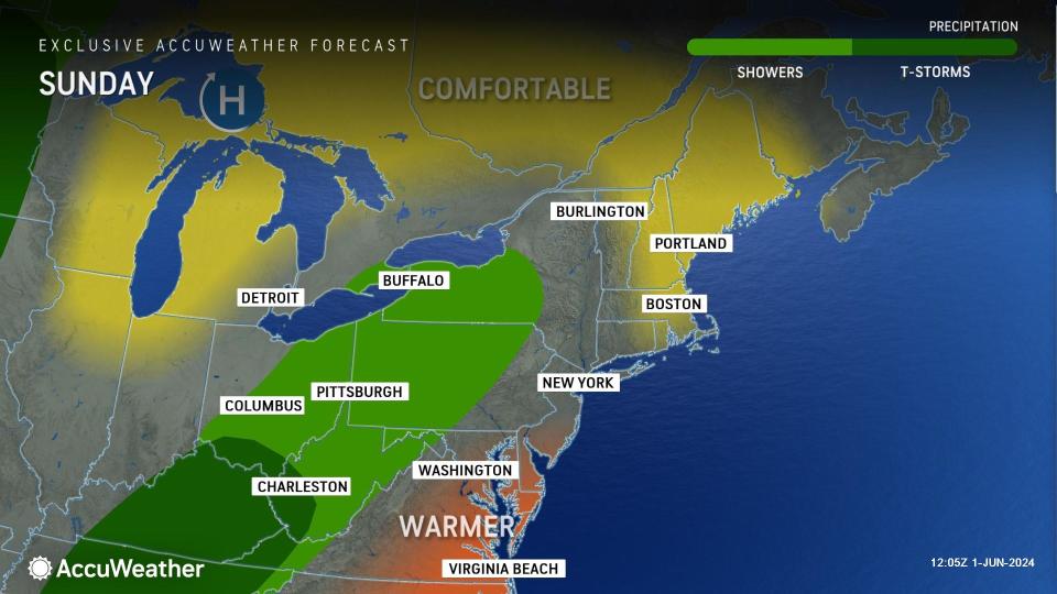
A system that brought rounds of downpours and severe thunderstorms to part of the South Central states late last week pivoted northeastward into the Midwest on Saturday. By Sunday, this feature is expected to turn eastward across the Appalachians and Northeast. Even though this system is forecast to weaken, it will still hold together enough to bring pockets of steady rain and spotty showers.
Showers can occur over the central and southern Appalachians at any time on Sunday, but rain may hold off along much of the Atlantic coast until later in the day or at night, Buckingham said. The rain may slide south of northern New York and central and northern New England.
However, even where rain holds off on Sunday along the mid-Atlantic and southern New England coasts, a return of moisture from the Atlantic may trigger an atmospheric response in the form of patchy low clouds and perhaps spotty drizzle. A chilly breeze will develop along the beaches.
 |
The moisture, with its clouds and rain, is likely to decrease over much of the Northeast from Monday to Tuesday and allow a further warmup, but the pattern may remain busy with clouds, spotty showers and thunderstorms farther to the south and west in the nearby Ohio Valley and Southeast states.
Want next-level safety, ad-free? Unlock advanced, hyperlocal severe weather alerts when you subscribe to Premium+ on the AccuWeather app. AccuWeather Alerts™ are prompted by our expert meteorologists who monitor and analyze dangerous weather risks 24/7 to keep you and your family safer.
