
 Yahoo News
 UK weather: Dozens of flash flood warnings as thunderstorms and torrential rain end heatwave
Dozens of flood warnings are in place across Britain as the country is set to be lashed by torrential rains after a blisteringly dry heatwave.
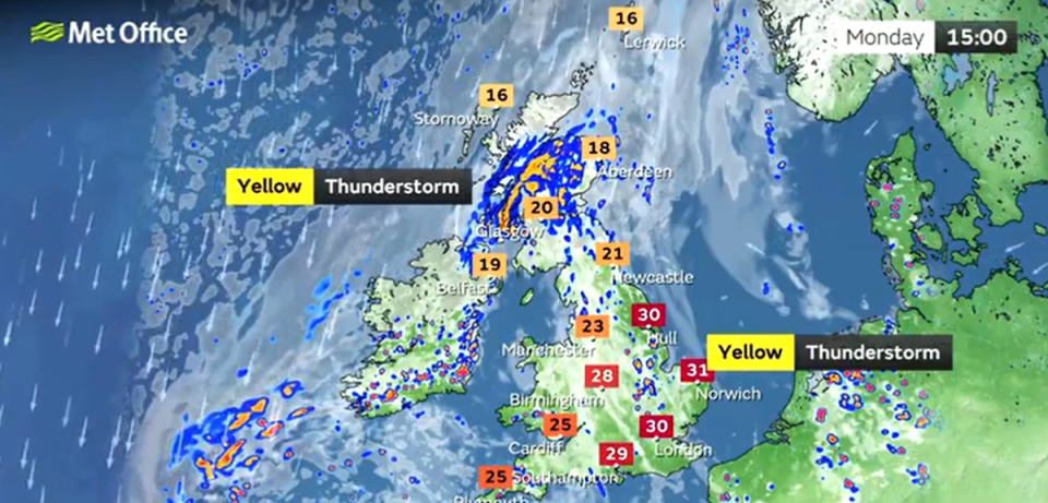
The Met Office has issued three days of weather warnings for heavy rain and thunderstorms covering most of the UK, starting on Monday.
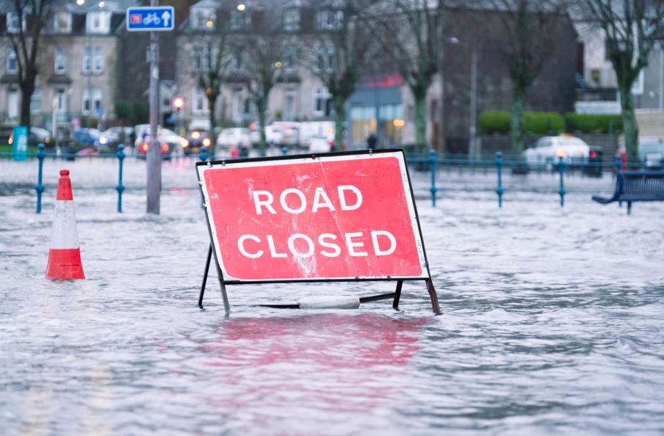
There are 33 flood warnings in place amid fears the baked ground will not be able to soak up such intense bursts of rain.
The downpours could produce 20-30 mm of rainfall in less than an hour, with 40-50 mm falling in around 2-3 hours in some spots, the Met Office warns.
“Homes and businesses could be flooded quickly, with damage to some buildings from floodwater, lightning strikes, hail or strong winds,” the weather service says.
Widespread power cuts could also be seen in areas most badly impacted by floods.
The flood warnings come after a drought was declared last week across swathes of England following the driest summer in 50 years.
Though downpours may seem to be the perfect antidote to the parched conditions, climate scientists have said that heavy rain does not soak easily in rock hard ground, which can lead to flooding.
Met meteorologist Simon Partidge said the low pressure moving to the UK is responsible for the cooler and wet weather.
Heavy, thundery rain at first across Northern Ireland and Scotland this Monday morning ⛈️
Drier elsewhere, but thundery rain soon spreading from the west, feeling very warm and muggy for many 🌡️ pic.twitter.com/gVXOzUrduE— Met Office (@metoffice) August 14, 2022
Speaking about the storms across the country, he said: “That’s due to this area of thundery rain gradually making its way eastward across all parts of the UK on Monday to bring some lowkey heavy downpours with some localised flooding possible. Also frequent lightning and hail is a possibility.”
He added the thunderstorms will persist overnight and well into Tuesday as well.
However, temperatures will not dip entirely as the mercury is still floating in warm weather territory, particularly on Monday as highs of 28C are forecasted.
Met Office Outlook
Today:
More unsettled and cloudier, although some sunshine too, particularly across southeastern areas of UK, where it remains hot. Showers and thunderstorms turning more widespread by afternoon, though some parts escaping. Less hot for many, feeling cool in wetter northern areas.
Tonight:
Thundery showers easing slowly across England and Wales, although some persisting, possibly turning heavier again later. Scotland sees more general rain, rain across Northern Ireland mostly lighter. Still relatively warm.
Tuesday:
Scotland and Northern Ireland often cloudy, but rain, mainly across Scotland, should ease; some sunny intervals in the northwest. Elsewhere, heavy showers and thunderstorms may produce torrential downpours. Less warm.
Outlook for Wednesday to Friday:
Heavy showers and thunderstorms across the south Wednesday, drier further north. Most places dry Thursday, but rain moving from the northwest, clearing southeast Friday to sunny spells. Cooler than recently.

