
 Yahoo News
 UK weather: Parts of England braced for more flooding as fresh alerts issued
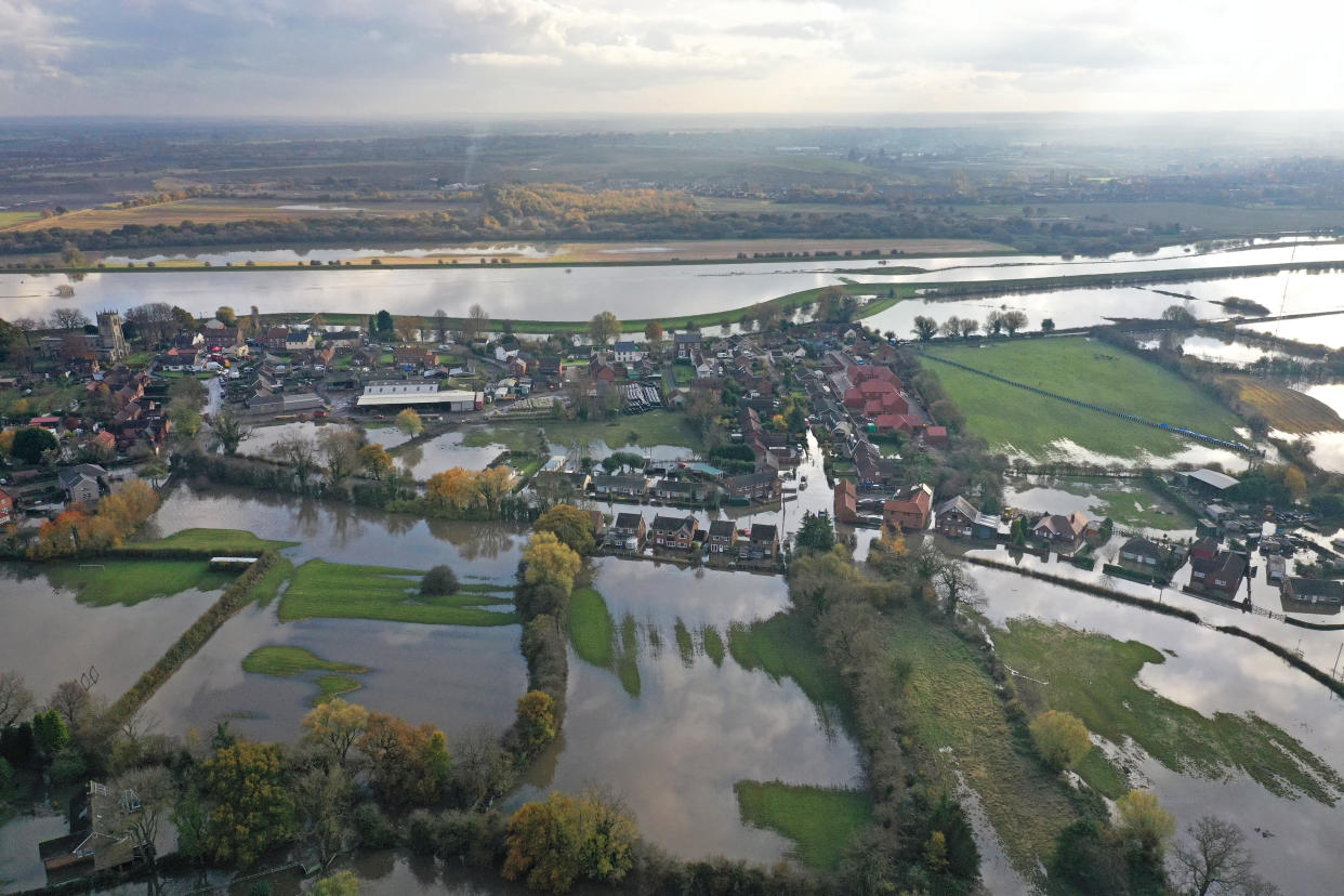
Parts of the UK are braced for even worse flooding as new alerts have been issued across the country.
A total of 70 flood warnings have been put in place as of Sunday, meaning flooding is expected and immediate action is required.
The Environment Agency has also issued 95 lower category alerts where flooding is possible and people should be prepared.
Most at risk are areas surrounding the rivers Severn and Avon in Gloucestershire, which burst their banks, and residents in parts of the Midlands and Yorkshire.

But despite some areas enduring their “wettest ever autumns”, much-needed relief from heavy rainfall has been forecast for flood-hit areas in the coming days.
Although river levels in some areas remain high, the Met Office said it has not issued any weather warnings as drier weather approaches.
Meteorologist Sophie Yeomans said: “There is some rainfall around, but it’s looking light and patchy.
“Sunday has the highest risk of rainfall, but the start of next week is looking quite dry.
“There’s light cloud and rain around in some of the areas in the north of England and also down in Shropshire and the West Midlands.
READ MORE FROM YAHOO NEWS UK:
Europe ‘warming faster than climate models projected’, research suggests
Bank holiday weekend sunshine continues as Britain to bask in 32C heat on Sunday and 33C on Monday
Britain’s August washout to be replaced by Bank Holiday weekend sun but don’t expect a heatwave
“But there’s no long-lasting or heavy rain – it’s a good situation.”
In a forecast of the flooding risk in England and Wales, the Environment Agency said: “River flooding is expected to continue in the Lower River Don washlands area in South Yorkshire through to at least Tuesday, where properties will continue to flood and there will be continued travel disruption.”
Sixty-six flood warnings and 106 flood alerts were still in place in England on Saturday evening.
Communities in parts of central and northern England continued the clean-up after being overwhelmed with water following torrential rain in recent days.
The EA for Yorkshire and the North East said there is still lots of flood water in the region, and a pumping operation is under way to reduce water levels.
In an online message, Martin Christmas of the EA, said: “We are starting to think about moving from emergency rescue response into recovery and that means looking at our flood warnings and then starting to think about all the inspections we need to do to look at potential repairs for banks and flood assets based on the loading they have received from the water in the last week.
“We have still got tens of people out there in the field carrying on with pumping activity trying to get levels at Fishlake reduced and we are also keeping an eye on East Yorkshire as well.”
The Met Office said its Sheffield weather station has recorded its wettest ever autumn.
It tweeted: “With 15 days still to go, the site has already recorded 427.6 mm of #rain. The previous record was set in 2000 with 425.2 mm of rain falling between September 1 and November 30 that year.”
There is also a “risk of seeing a very cold start” on Tuesday, according to Ms Yeomans, with potential temperatures of minus 5C.

