
 Yahoo News
 UK weather: Winds of up to 70mph are forecast to batter Britain this week


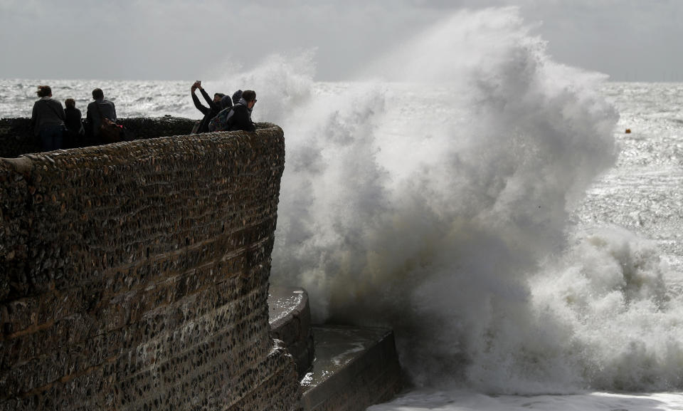
Winds of up to 70mph are forecast to batter Britain this week.
Two yellow weather warnings are in place for parts of England and Wales, with the Met Office predicting strong gusts across the country.
An area of low pressure will cause winds to pick up overnight in parts of Wales and South West England.
Gusts of between 55mph and 60mph on Monday morning could see disruption to rush hour traffic, particularly over the Severn Bridge, with difficulties for high-sided vehicles and possible speed restrictions.
Met Office forecaster Greg Dewhurst predicted an ‘unsettled autumn day’ across the country throughout the day.

A second area of low pressure coming in from the Atlantic is expected to bring more strong winds on Tuesday night, lasting into Wednesday morning.
‘It is likely to bring winds across many parts of England and Wales on Tuesday and Wednesday of between 50mph and 60mph, with isolated gusts reaching 70mph,’ said Mr Dewhurst.
MORE: Manatees left stranded on dried out ocean floor after Hurricane Irma ‘sucks water away’
MORE: Hurricane Irma: Shocking footage shows Florida streets turning into rivers
‘It could cause disruption to Wednesday morning rush hour and there could be some heavy rain associated with it as well.’
Meanwhile, flooding has hit motorways, roads and railways in the north of England.
Heavy downpours drenched the morning rush-hour with Greater Manchester Fire Service warning road users of the ‘horrendous’ driving conditions.
Motorists were left stranded in cars as localised flooding hit roads in Oldham, and further east of Manchester roads in Mossley were swamped by the deluge running off the Pennine hills into the village.
There are no reports of injury or damage to property.
Replacement bus services were put on for trans-Pennine train services between Manchester Victoria and Huddersfield after the railway line at Stalybridge, Tameside, flooded.
The line has now re-opened with trains running at a reduced speed.
Flooding also hit a section of the M60 motorway in Salford with Transport for Greater Manchester urging drivers to take extra care due to the amount of water on the roads.
The incoming high winds later this week could affect road, rail and air services, with longer journey times and cancellations possible.
There is a also small chance of power cuts, and some damage to buildings, such as tiles blowing off roofs, the Met Office said.
The warning covered the East Midlands, North East and North West England, Wales and the Yorkshire and Humber regions.
(Main picture: SWNS)


