
 Yahoo News
 Weather maps reveal when 0C chill will hit UK hours before 18C mini heatwave
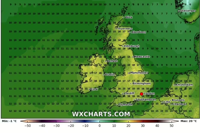
Temperatures will plunge to a chilly 0C before a 18C mini heatwave sweeps across the UK. Warmer conditions are predicted to follow the recent wet and windy weather seen across parts of Britain.
Weather maps from WX Charts indicate the mercury will drop to a frosty 0C at 6am in some areas on Tuesday, April 23. Most of Scotland and Northern Ireland will see the chilly lows, while parts of England and Wales are predicted to see temperatures between 2C to 4C.
But just two days later, the weather is expected to warm up. Balmy highs of 18C are expected in Scotland, Northern Ireland and Wales.
READ MORE: Meghan Markle 'following in Princess Diana's footsteps after turbulent few years'
Sign up to the BirminghamLive newsletter here to get the latest updates on the biggest and breaking stories.
It will be slightly chiller in England, with highs of 17C, Express reports. London and the south east of England appear set to see the coolest conditions on April 25, with temperatures hovering between 13C and 14C.
According to the Met Office, the period between April 14 and April 23 is likely to be 'unsettled', with snow predicted on higher ground. It comes as temperatures are predicted to rise this weekend, with 'sunshine and heat' anticipated.
Jim Dale, senior meteorological consultant at British Weather Services, said higher pressure will bring warmer conditions as we approach Friday, April 12. He said: "I would suggest 20-21C in the south is about the mark, not record temperatures but a least very pleasant."

