
 Yahoo News
 Weather warnings for UK as Hurricane Ophelia threatens 80mph gusts
Weather warnings have been issued across much of the west of the UK for Monday, with gusts up to 80mph brought by Hurricane Ophelia likely to cause transport disruption, while some areas in the east will be unseasonably warm.
The Met Office’s severe weather alerts warn of flying debris, potential power cuts, bridge closures and disruption to transport and mobile phone signal.
Ireland is expected to be worst hit by the remnants of Ophelia, with the Irish national meteorological service, Met Éireann, saying the country will face one of the most powerful storm systems in 50 years.
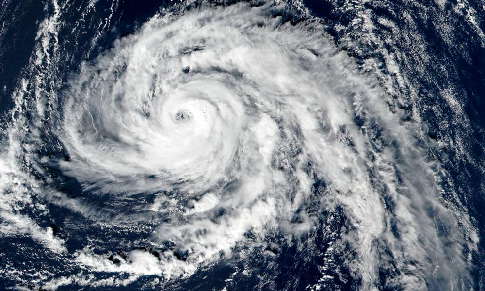
Ophelia was downgraded from a category three hurricane to a category two on Sunday, but will weaken to a storm when it hits the UK, exactly 30 years after the Great Storm of 1987 killed 18 people.
Very windy weather is expected across the entire west of the UK, with a yellow warning in place for much of Wales, Scotland, north-east England, north-west England, south-west England and the West Midlands. An amber warning has been issued for Northern Ireland.
The Met Office said affected areas could face power cuts and travel disruption. “Some damage to buildings, such as tiles blown from roofs, could happen, perhaps leading to injuries and danger to life from flying debris,” it warned.
There are yellow warnings for northern England and southern Scotland on Tuesday, but winds are expected to ease by the evening.
Red weather warnings are in place in Ireland, where the national emergency coordination group met on Sunday morning to discuss preparations. High seas, gale-force winds, storm surges and widespread heavy rain are expected.
A spokesperson said: “Irish Defence Forces are on standby to provide assistance. The public has been advised to stay off the roads during the height of the storm if possible and to avoid coastal areas.”
Dublin and Shannon airports are advising passengers to check the latest flight information before travelling, while Cork airport said cancellations were likely.
Beachgoers along the south coast of England have been warned to avoid hundreds of poisonous portuguese man o’ war blown ashore by the hurricane. The creatures – which travel by using a gas-filled bladder to act as a sail – can deliver a sting fatal to humans.
The storm follows a weekend of unusually warm weather, with some areas in the south reaching highs of 22C (71.6F) on Saturday, far above the average maximum October temperature for England of about 14C.
Temperatures in some areas of southern and eastern England are expected to exceed 20C on Monday, with isolated spots possibly reaching 24C or higher, due to warm air drawn up by Ophelia in Spain, according to the Met Office.
“Hurricane Ophelia is barrelling towards the UK, but it is weakening as it goes,” said a Met Office spokesman, Grahame Madge. “By the time it hits the cooler waters around the UK it will be a storm, but with gusts of wind up to 80mph in some areas and 50-60mph quite common it will certainly feel like a very intense weather system.”

