
 Yahoo News
 12-hour Kent thunderstorm weather warning as county urged to ‘prepare’
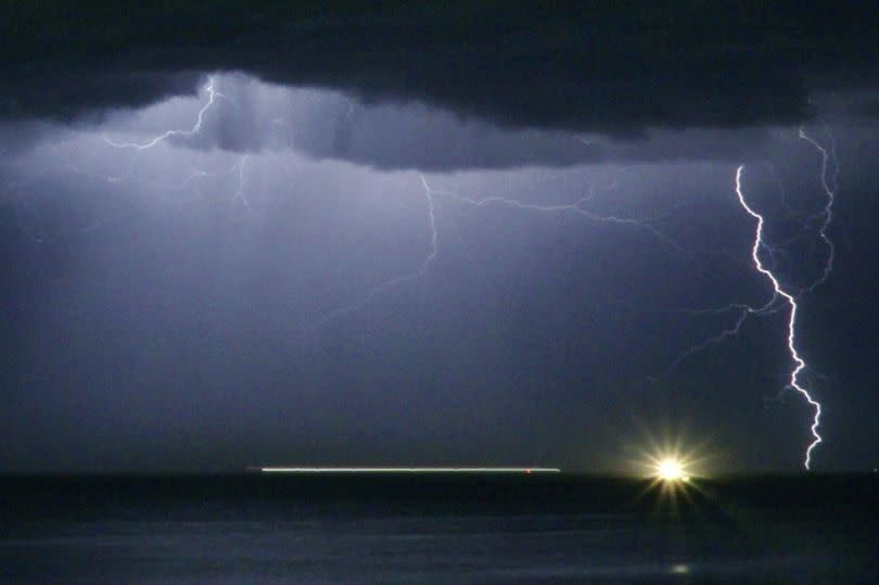
The Met Office has issued a new 12-hour yellow weather warning for thunderstorms today (May 21) and has urged the public to ‘prepare’. Blanketing the entirety of Kent, the alert comes into effect from 12pm this afternoon and will remain in place until 11.59pm tonight.
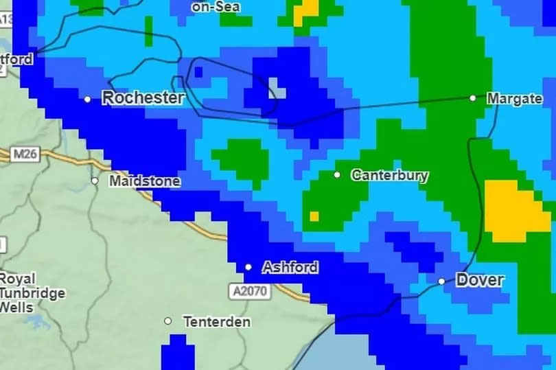
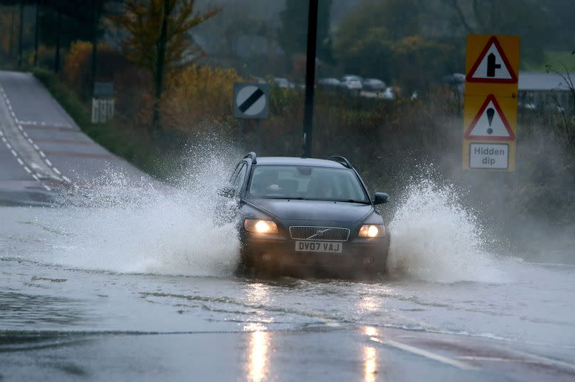
Forecasters have advised that flooding is possible where the alert is in place, with prolonged heavy rain expected throughout the day. Current weather maps predict persistent showers across Kent from the late morning until midnight and into the early hours.
Areas including Thanet, Dover, Ashford, Medway and Canterbury could see the heaviest rain, peaking between 1pm and 3pm. Met Office meteorologist Alex Deakin said: “A bit of wet weather here and there over central and eastern parts of England this morning, drifting up towards north west England, maybe north Wales at the same time. Down to the south east, we’ll see some more showers developing through the day.”
Read more: Person rushed to hospital after injury on train tracks near Sheerness
Read more: Sinkhole opens up in middle of Kent street
Where heavy showers develop, it has been warned that spray and sudden flooding could lead to difficult driving conditions and cause sudden road closures. Flooding and lightning strikes could also cause delays to train and bus services.
There is a chance for some power cuts and the loss of other services to homes and businesses amid the adverse weather. Homes and businesses could be flooded suddenly and the Met Office has urged the public to prepare a flood plan and emergency kit. The storm also brings a risk of damage to some buildings from lightning strikes, flooding and strong winds.
Current Met Office forecasts for the south east also state that the thundery showers may be joined by hail in some areas during the late afternoon. Temperature throughout the day will keep warm, peaking at 20C during the day and falling to 11C overnight.
A rainy and cloudy start is forecast again for Wednesday, with light rain expected across Kent during the morning. Heavy, persistent showers are likely to return by the afternoon which could turn thundery once more later in the day.
Drier conditions are expected between Thursday and the weekend, with cloud clearing to leave some warm sunny spells. As the weather warning approaches, there are many steps that can be taken to ensure your safety during a thunderstorm.
Before the thunderstorm
Unplug all non-essential appliances, including the television, as lightning can cause power surges and seek shelter if possible. When you hear thunder you are already within range of where the next ground flash may occur, lightning can strike as far as 10 miles away from the centre of a storm.
During the thunderstorm

Avoid using the phone, taps and sinks - this is because metal pipes and telephone lines can conduct electricity. If outside avoid water and find a low-lying open place that is a safe distance from trees, poles or metal objects.
It is also advised that you avoid activities such as golf, rod fishing or boating on a lake. Be aware of metal objects that can conduct or attract lightning, including golf clubs, golf buggies, fishing rods, umbrellas, motorbikes, bicycles, wheelchairs, mobility scooters, pushchairs, wire fencing and rails.
If you are in a tent, try to stay away from the metal poles. If you find yourself in an exposed location it may be advisable to squat close to the ground, with hands on knees and with head tucked between them.
Try to touch as little of the ground with your body as possible, do not lie down on the ground. If you feel your hair stand on end, drop to the above position immediately.
After the thunderstorm
Avoid downed power lines or broken cables. If someone is struck by lightning, they often suffer severe burns. The strike also affects the heart, so check if they have a pulse.
Driving in a thunderstorm
If you are caught out in thunder and lightning it is advised that you wind up the windows and stay inside your car. This is because in the vast majority of cars with a metal roof and frame, the frame will act as a conductive Faraday cage, passing the current around the passengers inside and on to the ground.
Soft-top convertibles, with their fabric roofs, are the most at risk and could catch fire if struck by lightning. Current can travel through other parts of many modern cars, including GPS and radio systems.
Cars with metal interior handles, foot pedals and steering wheels can also carry current. Cars can be damaged both internally and externally by lightning strikes.
Thunderstorms can also bring a risk of sudden gusty winds, those most at risk would include cyclists, motorcyclists and high-sided vehicles. Remember to give vulnerable road users including cyclists, motorcyclists and pedestrians more room than usual.
They are more likely to be blown around by side winds – always keep a safe distance. Keep your speed down, lowering your speed will lower the distance you travel when buffeted around by the wind.
Hail storms can be extremely dangerous to drive in reducing your ability to see and be seen, as well as causing damage to your vehicle. If hail is severe, stop and pull over to a safe place and remain inside the vehicle.
Get more news from KentLive straight to your inbox for free HERE.

