
 Yahoo News
 Exactly when 9-inch snow bomb to hit UK as experts say 'it's likely'
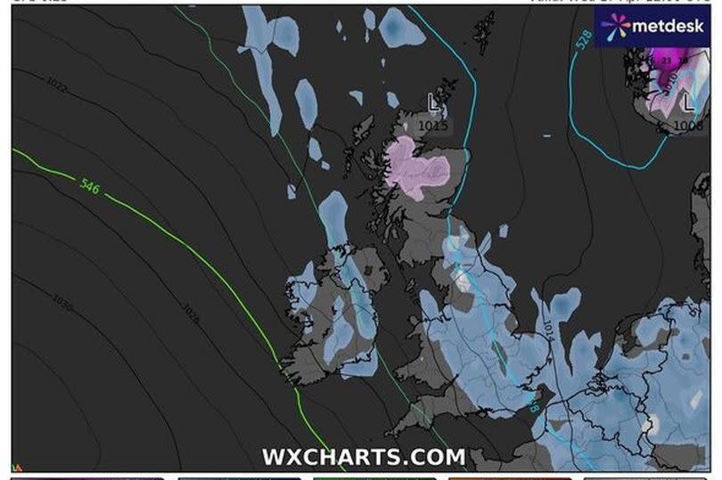
Snow maps have revealed that Britain is bracing for a barrage of snow in mere hours as an Arctic freeze sweeps across the nation, with parts of England anticipating nine-inch flurries.
According to WxCharts, which utilises Met Desk data, there's a likelihood of snowfall hitting Yorkshire, areas of northwest England, Wales, and Scotland.
The forecaster currently pegs the chances at about 60 per cent for most of those regions to see snow on Wednesday, April 17. In other news, various parts of the UK are expected to endure a bitter chill, with temperatures plummeting to zero degrees Celsius. The Midlands, Wales, and vast swathes of the south are predicted to face this cold snap come Thursday, April 18.
Scotland is forecasted to bear the brunt of this snowy onslaught, reports the Express. The northern reaches around Inverness could see up to nine inches of snow, while England's snowfall is likely to be limited to 2cm flurries, according to forecasters.
READ MORE: Major DVLA change would force millions of drivers to take urgent action
Get breaking news on BirminghamLive WhatsApp
Weather expert James Madden from Exacta Weather has commented: "Colder and wintry in places before gradually becoming more settled and much warmer to hot on cue by month end or early May."
He added, "However, throughout Tuesday evening and into Wednesday, it will be cold enough for these showers to turn wintry and to snow once again across parts of the far north and Scotland."
"There is also the possibility and it will also be cold enough in certain parts of northern/northeast and southern/southeast England overnight and into early Wednesday for these showers to turn temporarily wintry and to sleet or snow in places."
"Following on from this will see high pressure and more settled weather finally beginning to take hold; however, it is still likely to be on the cool side to begin with, and before temperatures start to finally warm up significantly during the final third of April and into early May, as covered in all of our earlier and longer-range weather reports for in and April 20 onwards and preceding a cold period."
"It is within this period that we could see maximum temperatures ranging in the mid to high 20's, at the very least for the first time this year and over a sustained time period."
The Met Office meanwhile says there will be sunny spells and scattered showers throughout Wednesday, with winds "lighter than of late". It says there will be breezes on the east coast. Thursday is expected to be rather cloudy with light rain spreading south.
The forecast states: "Settled conditions developing from Friday with some sunny spells especially in the west and temperatures increasing." The Met Office says Sunday should be dry for most people, albeit there could be warm light winds in places. There could be light rain in northern parts of the country.
The Met Office's long-range forecast suggests: "Into next week the high is likely to withdraw to the west a little, and this will open the door to cooler and less settled conditions, with some rain or showers mainly affecting the north and east, with the best chance of staying dry across western and southern parts."
"After a brief warmer interlude on Sunday temperatures are likely to trend back toward or a little below average."

