
 Yahoo News
 Are the hazardous rocks in Lake St. Clair on government navigation charts? Harbour master says they aren't
Alarm has been raised about a pile of rocks that lie just under the surface of the water of Lake St. Clair near the shore off the 400 block of Russell Woods Road in Lakeshore.
According to Transport Canada, the governmental body responsible for the hazards in bodies of water, boaters should know they are there if they are using government charts for navigation.
"The rocks referenced along the St. Clair shoreline are identified and charted in publicly available nautical charts published in the Department of Fisheries and Ocean's Canadian Hydrographic Service," reads part of a statement from Transport Canada to CBC News.
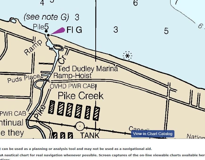
But when CBC checked with Windsor Harbour Master Peter Berry, he could find some rocks marked on his charts but not the rocks in question.
"From what I can see in the chart... there shows some areas that are rocky it doesn't match the description on the chart to the location that we're seeing with these rocks. So they're a bit of a mystery," said Berry.
When CBC News reached out to Transport Canada to seek an explanation, a spokesperson sent back a picture of the chart with an asterisk at the approximate location of where the rocks are.
But Berry said it was a marker for a sewer outlet. CBC News is awaiting another response.
Windsor Power and Sail Squadron public relations officer Jim Atkinson knows the rocks well and also he confirms they aren't on federal government charts he has.
He says a private firm called Navionics, which is affiliated with the Garmin navigation system company, has a more detailed electronic charting system that shows the rocks in question.
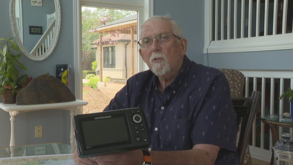
"So the Canadian government does big rocks, Navionics does little rocks, and they really need to work together," said Atkinson.
Atkinson said boaters can buy GPS systems called chartplotters that are similar to a cars navigation system and those will show the rocks.
He says the federal government should mark the rocks with a permanent buoy.
Joe Mikhail, one of the residents who is concerned about the rocks, says a lot of boaters don't have the charts or navigational aids and people on personal watercraft don't either.
Meanwhile, Windsor-Tecumseh MP Irek Kusmierczyk has reached out to the transport ministry and has gotten the same answer. A spokesperson for Kusmierczyk's office says they continue to press for updated information.
"Safety is my number one concern," said Kusmierczyk in a recent interview.
The councillors in the Municipality of Lakeshore will vote on whether to send a letter to Transport Canada requesting signage for the rocks when they meet on June 25.

