
 Yahoo News
 Incredible before and after pictures shows the destruction of volcano that caused Indonesian tsunami

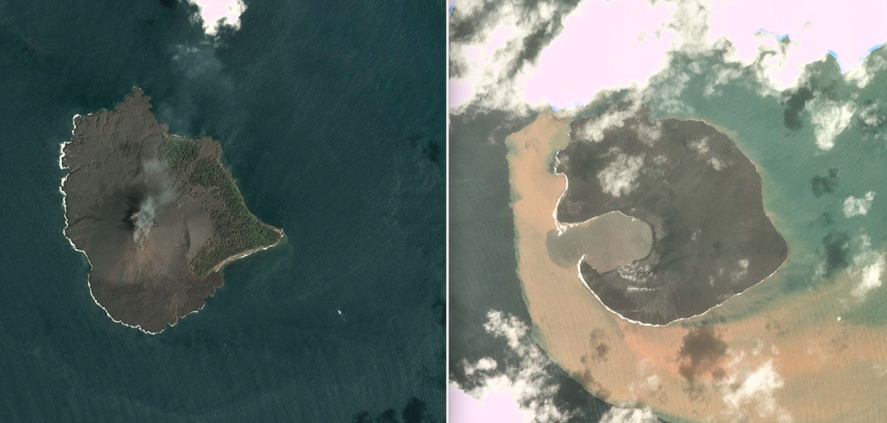
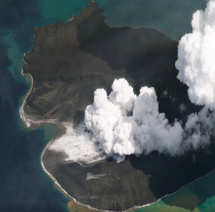
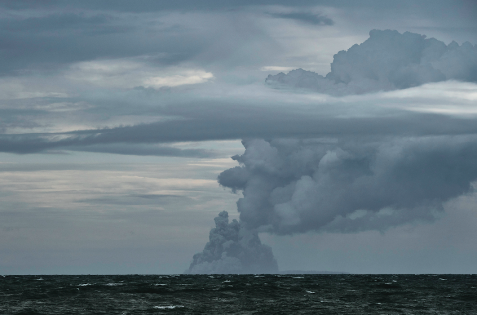
These incredible satellite photos show the full extent of the collapse of the Anak Krakatau volcano, that caused the Indonesian tsunami in December.
Planet Labs Inc have released images taken from its Dove and Skysat platforms that show how the island volcano has been completely reshaped.
A large section of the western side has completely vanished, while the island itself has changed shape dramatically.
A crater that was situated one top of the 340m-high volcano has now broken open completely, forming a small bay.
Some 170 million cubic metres – more than two-thirds of Anak Krakatau’s volume – is now missing, presumed to have fallen into the sea in a massive landslide that produced the tsunami.
MORE: There’s a snake in my dishwasher! RSPCA reveals weirdest animal rescues of 2018
MORE: Police attempt to reunite £2m haul of property stolen by prolific crime gang with owners
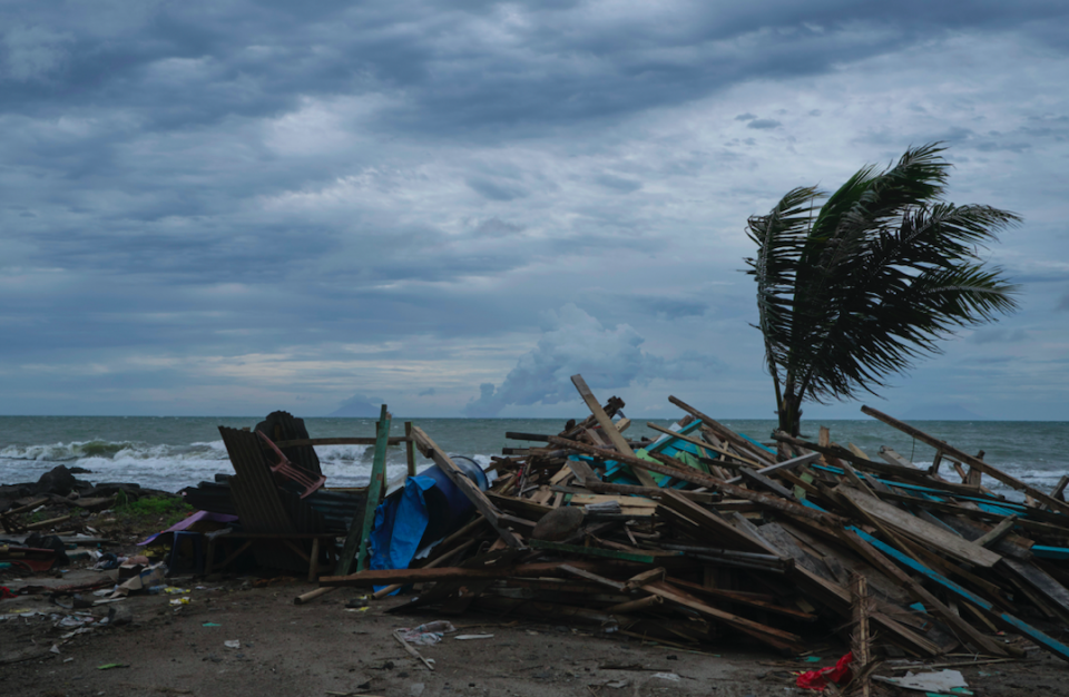
The eruption of the island volcano in December sent a 20 metre-high wall of water inland, damaging hotels and houses, resulting in the deaths of around 430 people.
Thousands more people remain displaced.
Anak Krakatau is an island formed from previous blasts from Krakatoa.
The tsunami came less than three months after a 7.4-magnitude earthquake struck central Sulawesi, causing widespread damage and killing 2,256 people.
More than 70,000 homes were said to have been damaged, while communications, water and electricity infrastructure was also severely impaired.

