
 Yahoo News
 Met Office issues second thunderstorm warning for parts of Wales in two days
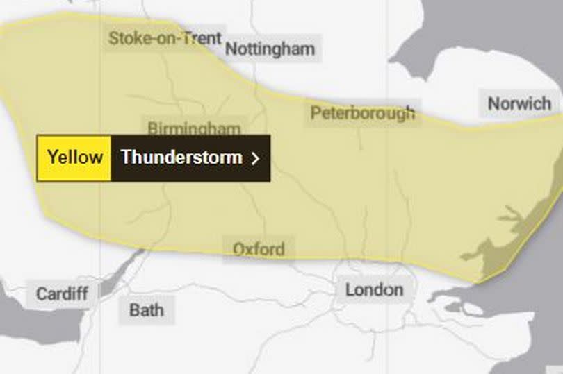
Another thunderstorm warning has been issued for a large part of Wales on Thursday afternoon (May 2). It comes just hours after the Met Office's first yellow warning of torrential rain and storms came to an end.
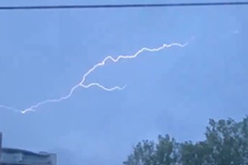
Thousands of thunder claps were recorded overnight mainly in the south of England, but there were some in parts of Wales too. The latest warning is in place from midday until midnight on Thursday.
It states: "While some areas will remain remain dry, thunderstorms are likely to develop this afternoon and evening from the east and move relatively slowly westwards or northwestwards. Where thunderstorms occur, heavy rain accompanied by frequent lightning is likely with potential for 25 to 30 mm of rain to fall in one or two hours in a few places and perhaps as much as 50mm could fall in one or two spots. In a few places there may also be some hail."
READ MORE: The election happening today in Wales
READ MORE: M4 and A48 travel updates as heavy rain causes delays and major bridge closed
In Wales, the warning area covers: Conwy; Denbighshire; Flintshire; Gwynedd; Monmouthshire; Powys; Wrexham.
Thursday could still be the warmest day of the year even with the warning for heavy rain and thunderstorms. Marco Petagna, a meteorologist at the Met Office, said some places could see their warmest temperatures of the year on Thursday. This would come a day after Wednesday saw temperatures peak at their highest yet in 2024 at 22.1C.
He told the PA news agency: "After a night of storms, the rain will ease in the south of England for a while tomorrow. We could see the skies brightening up in a few places and it will be another warm day. Parts of the South East could even get to 24 degrees and beat today's temperatures.
"But as the skies brighten and temperatures increase, this could spark a few more thundery showers in the afternoon, so it is likely to still be a bit unsettled and the forecast will be changeable over the next few days."
The Met Office advised the storms might cause travel disruption and some flooding, leading to "difficult driving conditions and some road closures".
Two buildings in Sussex were damaged by lightning strikes overnight, according to West Sussex Fire & Rescue. A care home in Elmer was struck with damage to its roof while a university building in Chichester sustained damaged to its roof and power system.
Looking ahead to the Bank Holiday weekend, Mr Petagna said the forecast showed a "very mixed picture" for the UK.
Most areas of the country are likely to experience some rain but temperatures will remain fairly warm, in the mid to late teens. There are likely to be showers across the country on Monday.
Wednesday was the warmest day of the year so far, as temperatures reached a peak of 22.1C in Santon Downham in Suffolk. Meanwhile, the temperature in Scotland reached 21.9C in Aultbea in the north-west Highlands.
However, while some areas of the UK experienced their warmest temperatures of the year, there were wide variations across the country. Cloud stopped the sun coming through in Wales which meant the temperatures did not rise so high.
The Met Office forecast for Wales for the next five days says: "Heavy, thundery rain through Thursday morning, easing for a time, but with further outbreaks arriving through the afternoon. Best of any drier, brighter and warmer spells across North Wales, but even here some showers possible. Cool under cloud and rain. Maximum temperature 18 °C. Rain and drizzle will continue overnight, with further heavy bursts at times. Cloud becoming extensive with mist and murk for most by dawn. Minimum temperature 7 °C."
It adds: "Generally overcast on Friday with further spells of rain and drizzle, slowly easing. Perhaps becoming brighter across South Wales later in the day. Maximum temperature 16 °C. Remaining changeable over the weekend with showers of longer spells of rain at times, mixed in with some sunshine. Feeling warm in any sunshine and light winds."

