
 Yahoo News
 Met Office temperature forecast for each part of Wales with heatwave due
Parts of the UK are bracing for a potential heatwave this week with temperatures predicted to soar close to 30C in some regions. Even if the country doesn't quite hit the official heatwave mark it's set to be the hottest spell of 2024 so far, according to the Met Office.
The weather experts define a heatwave as a minimum of three consecutive days where temperatures surpass a certain threshold. With this in mind they're forecasting a four-day period of exceptionally warm weather starting from Monday, June 24, and lasting until Thursday, June 27, reports WalesOnline.
Most of the UK can expect temperatures in the mid-20s with some spots potentially hitting a sweltering 29C. A Met Office chart reveals the areas likely to experience the warmest conditions. We've examined the Met Office weather maps to bring you the forecast for every corner of Wales as the anticipated heatwave approaches.
READ MORE: Anger explodes in Denbighshire as people 'become unpaid refuse workers' to clear waste backlog
READ MORE: Video shows moment man throws stone at seal on North Wales beach
Monday, June 24
10am
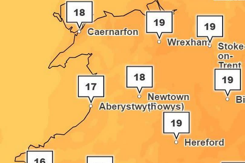
As the week begins most of Wales will see temperatures ranging from 16C-19C. The Monmouth area is expected to be the warmest with temperatures reaching around 20C.
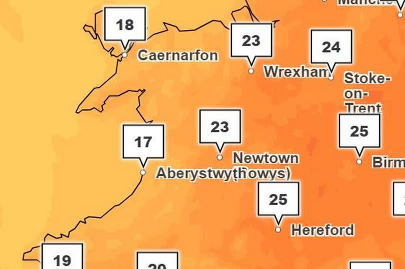
2pm

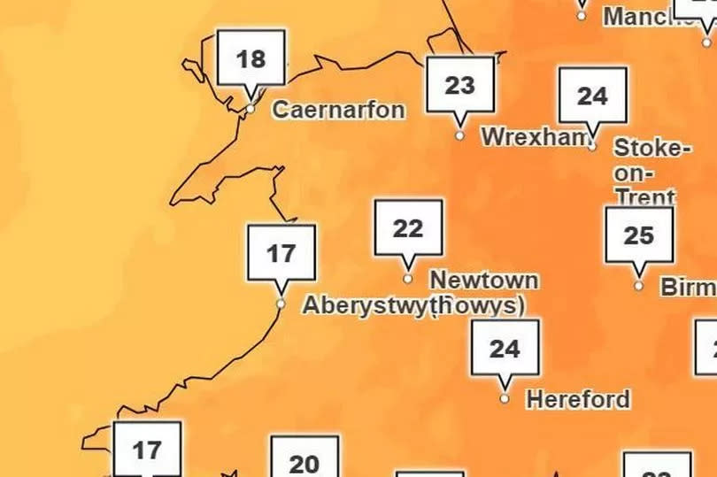
By the afternoon temperatures are set to rise to approximately 24C in Wrexham, 23C in Newtown, and 21C in Cardiff.
6pm
By evening a warm spell is expected in some regions, particularly in the southeast and up to mid Wales. However temperatures will have dipped along the west Wales coastline, especially in Pembrokeshire and Ceredigion.
10pm
As the night progresses most areas will see temperatures fall below 20C.
Tuesday, June 25
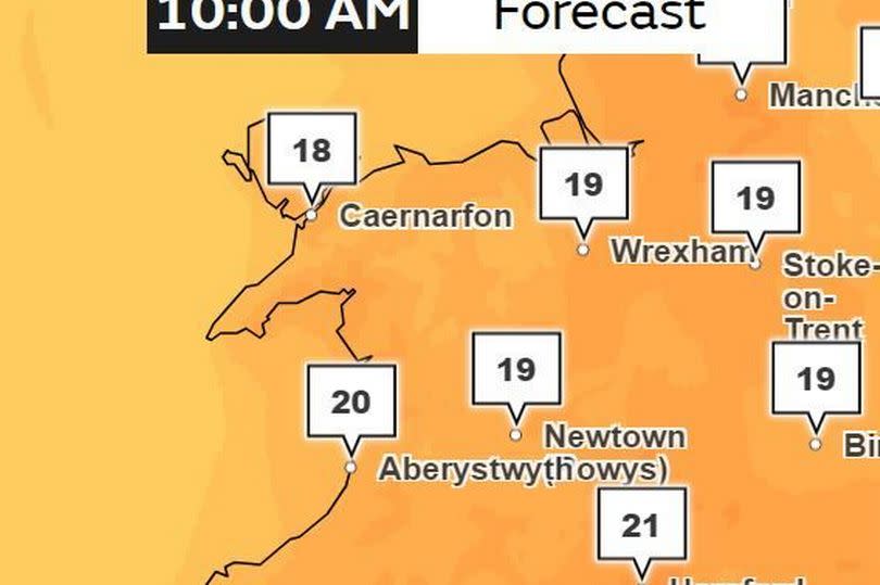
10am
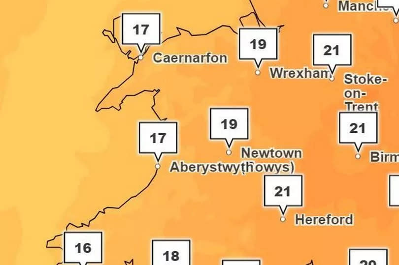
The Met Office predicts Tuesday morning temperatures of around 19C in places like Cardiff, Newtown, and Wrexham. While it will be 21C in some parts across the border the Welsh coastline will be significantly cooler at around 16C-17C.
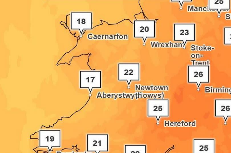
2pm
Border areas will experience 25C while places like Wrexham and Newtown will see 23C. Cardiff will be 22C and Swansea 20C with Pembroke at 19C and Caernarfon at 18C.
7pm
Come 7pm on Tuesday it appears the warm weather is set to persist with eastern regions seeing temperatures in the 20s.
Wednesday, June 26
10am
Wednesday morning continues the trend of warm weather.
1pm
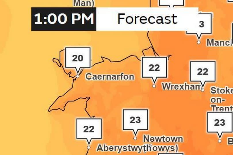
Wednesday afternoon is forecasted to bring 23C to places like Cardiff and Newtown, 22C to Aberystwyth and Wrexham, while Swansea and Pembrokeshire will see 21C.
4pm

By 4pm on Wednesday most of Wales will remain above the 20C mark.
7pm

Temperatures in their 20s are expected to hold steady throughout the afternoon and into Wednesday evening.
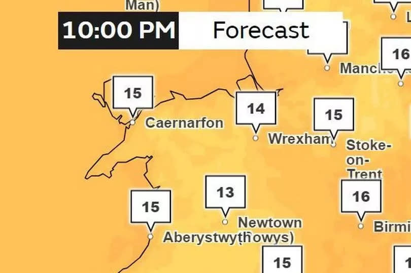
Thursday, June 27
10am
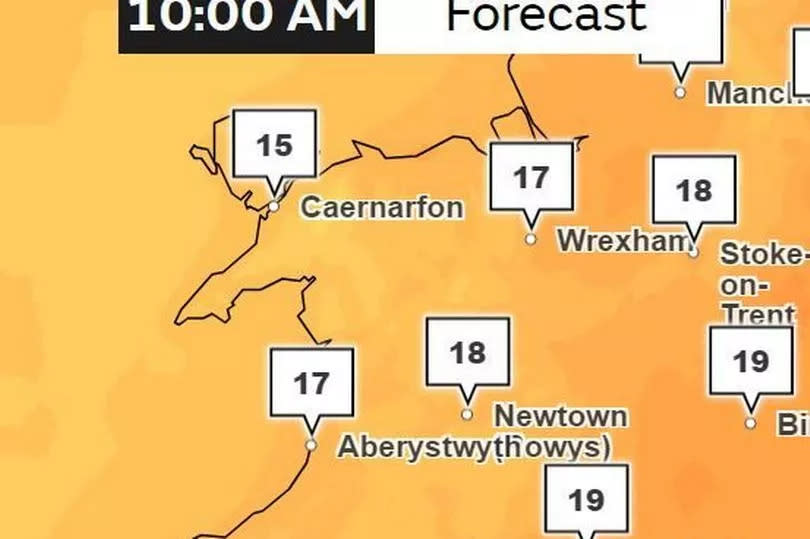
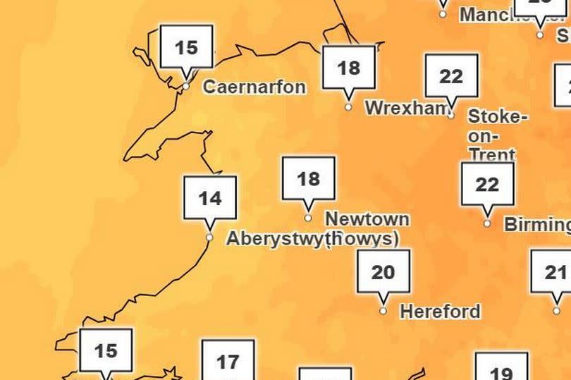
Temperatures will have dropped in comparison to the weather experienced on Wednesday morning with temperatures around 15C in areas such as Caernarfon, 17C in Wrexham and Aberystwyth, and 18C in Newtown and Cardiff.
4pm

By 4pm temperatures will have risen for most parts of Wales according to the Met Office.
10pm
The outlook for the rest of the week:
After four days of warm weather however, the Met Office forecasts there will be more unsettled weather expected to return with Wales turning cooler and wetter. The forecaster predicts that although temperatures could reach a peak on Wednesday the breakdown of this high pressure from Tuesday night into Wednesday could turn things more unsettled.
With this breakdown there is also the chance of some heavy showers or thunderstorms in places with the most persistent rain likely in the west or southwest. For its forecast between Friday, June 28, and Sunday, July 7, it forecasts: "Fresher conditions with a westerly wind from the Atlantic and changeable weather is most likely to prevail through much of this period; the hotter and more humid weather experienced by the south prior to this will most likely have been pushed away into the nearby continent.
"However, there remains at first, a small risk that these conditions could linger for a time in the south, with the change to fresher weather more erratic with a chance of more widespread thunderstorms. This aside western areas are likely to see the most frequent rainfall whilst eastern areas remain drier and a trend towards more generally settled weather through the period is probable. Temperatures expected to be around to a little above average."

