
 Yahoo News
 All the mobile speed camera locations across Leeds this week
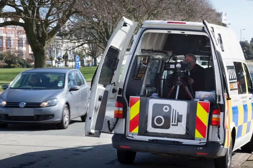
Mobile speed cameras have been put into place in areas across Leeds as the authorities work to reduce the number of accidents and speeding cars.
Initially, the cameras are placed in core camera sites, which are places with a high level of casualties and speeding vehicles where analysis show mobile enforcement is the best way to reduce them. Others are then put into place in community concern sites, which are areas which do not meet the criteria for core sites, but which have been highlighted by locals.
The cameras work by pointing a laser at passing vehicles which calculates the speed at which they are driving. This laser works in a wide range of light and weather conditions.
Read More: All the criminals locked up in Leeds in June from teen killer to ‘dangerous predator’
Mobile speed camera locations are subject to change with no notice, and these locations are accurate at the time of publishing. Here are the mobile speed camera locations in Leeds this week.
30mph sites
A61 Wakefield Road/ Leeds Road, Rothwell - between Middleton Lane and Leadwell Lane
A65 Otley Road, Guiseley - between A6038 Bradford Road and B6153 Park Road
broad Lane, Sandford - between Whitecote Hill and Waterloo Lane
Otley Old Road (Statics on Site) - between Holtdale Approach and Spen Lane.
A58 Whitehall Road, Drighlington - between 40m East of King Street and 75m East of Old Lane
King Lane, Leeds - between 200m North Alwoodly Lane to 50m North Ring Road
Queenswood Drive, Leeds - between Queenswood Gardens and 229 Queenswood Drive
Dewsbury Road, Leeds between Victoria Road and Holmes Street
Harewood Road, Collingham
Tong Road, between Pipe and Nook Lane and Whingate
A635 Penistone Road, between Huddersfield Road and 300m North East of Sude Hill Terrace
40mph sites
A653 Dewsbury Road, Woodkirk, Leeds - between Lowry Road and Quarry Lane
A58 Easterly Road, Leeds - between Easterly Grove and Boggart Hill Drive
A61 Harrogate Road, Alwoodley - between Fir Tree Lane and Alwoodley Lane
A639 Leeds Road, Rothwell - between Rothwell Lane / Calverley Road and Junction 44 of the M1
A639, Methley - between the junction of The Hollins and 110m East of Green Row
Stanningley Road, Bramley between Henconner Lane and Back Christ Church View
A660 Leeds Road, Pool - between Cabin Road and 290m west of number 6 Cragg View (NSL Signs)
A657 Carr Road – Between Clara Drive and 45m N/E of Carr Wood Gardens
A65 Abbey Road – Between Butlers Wharf and Back De Lacy Mount
A647 Bradford Road – Between Dawson’s Corner and Gain Lane (Thornbury Gyratory)
50mph sites
A62 Gelderd Road, Gildersome - between 42A Gelderd Road and Railway Bridge
A6120 East Leeds Orbital road
A63 Selby Road, Swillington

