
 Yahoo News
 UK weather forecast: What will the weather be like during the half-term break this week?
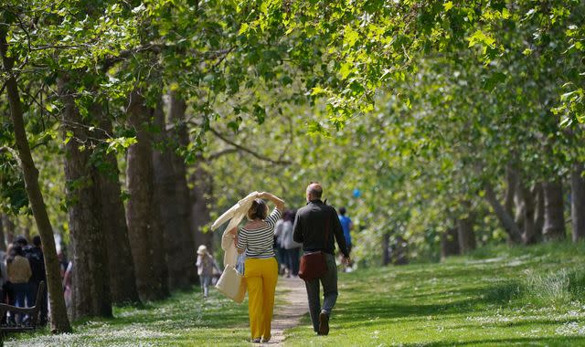
Half-term has arrived and so have sunny spells.
"High pressure will dominate for the rest of this week, bringing mostly dry conditions," according to Sky News weather producer Joanna Robinson.
It has been predicted that some western parts of the country can expect sunshine and high temperatures, "which will widely reach the low twenties," she said.
Ms Robinson added it could get even hotter though: "25 or 26C is possible over the next day or two, with central and western Scotland most favoured."
Some eastern parts of the UK are "likely to see more in the way of cloud, especially eastern England, which will keep things rather cool".
While "some North Sea coastal areas will struggle to reach the mid-teens," Ms Robinson added.
She also said the pollen count and UV levels would be high for most of this week, adding the risk of fire would also be higher than usual: "The fine, warm and blustery conditions in the south does mean that the fire severity index for England and Wales has been raised to very high in places."
As for those heading to southern Europe for the half-term holidays, Ms Robinson said: "The unsettled weather will continue, with further heavy showers and thunderstorms around."
So it could be a rare case of the UK getting better weather than elsewhere.
'Dry and settled weather' but not a heatwave
Met Office meteorologist Dan Stroud also said some areas will see higher temperatures.
"But after that we're expecting temperatures just to subside just a little as we move forward towards the middle and end of the week," he added.
Mr Stroud said temperatures would remain "generally above average" but not meet "heatwave criteria".
He said: "We've got high pressure sending across at the moment, which is bringing dry and settled weather and some late spring, early summer sunshine."
The Met Office website shows clear but slightly cloudy skies this week, with temperatures peaking at 21C in London.
So with Sky and the Met Office both having positive forecasts, it's time to grab your sunscreen and get ready for a week of sunshine.
UK maximum temperatures and weather during half-term
Here is the weather forecast for the half-term in some of the UK's key cities:
• Aberdeen - 14C (today and Sunday 4 June). Sunny intervals at the weekend after a largely cloudy week.
• Belfast - 21C (today). A sunny, dry and warm week.
• Birmingham - 19C (Sunday 4 June). Saturday 3 June the sunniest day, after sunny spells for much of half-term.
• Bristol - 21C (Thursday and Sunday). The weekend looks like it will be the sunniest part of the week.
• Cardiff - 20C (Thursday 1 June). Best of sunshine on Thursday and at the weekend but a dry, warm week.
• Edinburgh - 16C (Saturday). Thursday could be overcast, with a fair amount of cloud around all week, except on Saturday.
• Glasgow - 22C (Wednesday 31 May). Sunshine all week but a higher chance of cloud on Thursday and Friday.
• Liverpool - 20C (all week apart from Friday 2 June). A dry week with the best sunshine on Friday and Saturday.
• London - 21C (Wednesday, Saturday and Sunday). Some cloud around every day apart from Saturday.
• Manchester - 20C (Sunday). Best of the sun on Friday and Saturday in a sunny, warm week.
• Newcastle - 14C (Sunday). A cloudy week, with Thursday set to be the dullest day.
• Norwich - 16C (Sunday). Overcast on Wednesday, Thursday and Sunday. Cloudy on Friday and Saturday.
• Plymouth - 21C (Wednesday and Thursday). A sunny, dry and warm week.
• Sheffield - 18C (Sunday). A cloudier week than most.
• Southampton - 21C (Wednesday). Thursday to Sunday looks sunny and hot.
Read more:
Calls for sunscreen to be VAT-free as charity warns about poverty and cancer link
London's day-by-day half-term forecast
Here is a day-to-day breakdown of this week's half-term weather in Greater London:
Tuesday 30 May
The day started off slightly cooler, but from around 3pm, London is set for clear skies, with the highest temperature peaking at around 20C for the day.
At around 7pm, we'll start to see clouds rolling through as the sun slowly starts to settle for the day.
Chance of rain: 5%
The lowest temperature of the day: 11pm - 13C
Wednesday 31 May
The day is expected to start off cooler at around 10C, with the forecast of clouds likely to take over till about 3pm.
By 4pm, we'll see some sunny spells and reach high temperatures of 20C. By 8pm, the weather will start to cool down.
Chance of rain: 10% till 1pm and then from 2pm it will be about 5%.
The lowest temperature of the day: Between 2am to 7pm - 11C.
Thursday 1 June
The day is set to start off cloudy, with temperatures predicted to hit 13C at 10am and rise between 1pm to 4pm.
At 4pm we will see a ray of sunshine as the weather is predicted to peak at around 19C.
Chance of rain: 10% from 1am-7am and then 5% from 10am for the rest of the day.
The lowest temperature of the day: 4am at 10C.
Friday 2 June
The Met Office has predicted highs of 19C at 4pm on Friday, with some clouds making their way into the sky during the day.
Chance of rain: From about midnight till 10am there will be a 10% chance of rain and at 1pm this will drop down to about 5%.
The lowest temperature of the day: Between 4am to 7am at around 10C.
Saturday 3 June
More sunshine is forecast this weekend as clear skies are set to make an appearance.
On Saturday, we'll see clear skies from 10am till about 7pm as temperatures peak to 20C at 4pm.
Chance of rain: 5%
The lowest temperature of the day: 4am to 7am at 9 C.
Sunday 4 June
More dry and sunny spells are predicted for Sunday as the highest temperature of 21C is set for 4pm.
From 10am we should see clear skies as the sun shines on the city.
Chance of rain: 5%
The lowest temperature of the day: 4am is set to be around 11C till around 7am.

