
 Yahoo News
 Why does it feel so cold in the UK right now – and when will it warm up?
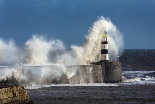
It looks like spring, but it doesn’t feel anything like it. The trees have green leaves, the flowers are blooming, yet it’s hard to believe that next week is May, because it feels so cold.
It won’t come as a surprise that temperatures have been well below average this week, especially in eastern areas of the UK where they’ve stayed stubbornly in single digits. The atmospheric observatory at the University of Reading indicates the average daily maximum temperature for April so far is 14.4°C – that’s 0.4°C above average. This follows the warmest March recorded globally at 1.68°C above our pre-industrial climate and the tenth consecutive record warm month.
How we feel, whether it’s warm or cold outside, depends on more than just the actual air temperature though. The wind, both its speed and direction, plus the amount of sunshine all play a big part in how the weather feels to us.
My back garden faces north east and when the wind blows from the chilly North Sea in the spring, it feels cold. Sitting out the front in the Sun with some shelter feels much warmer though. That’s partly because the sunshine is as strong in April as it is in August. The Sun sits at a higher angle in the sky and its energy is more intense in late spring and summer compared to the autumn and winter.
Read more: 'April showers' – a rainfall scientist explains what they are and why they are becoming more intense
By the end of March, I was looking ahead and hoping again for some high pressure to end the deluge of rainfall through winter and bring some much needed drier weather. High pressure comes from a heavy atmosphere, caused by air sinking towards the ground. Once settled in, that high pressure blocks the usual low pressure weather systems that tend to sweep across the UK throughout the autumn and winter.
Chill factors
Fortunately, there was high pressure in the forecast. Unfortunately, that high pressure was in the “wrong” place for it to feel like spring had arrived. The high pressure has been mainly across the Atlantic out to the west or north west of the UK. Air circulates around the centre of the high in a clockwise direction. This means the air has travelled to the UK from far north near Greenland in the Arctic where the seas are freezing at this time of year.
The Arctic air is also very dry. You might have noticed your skin feeling drier than usual lately, or that you can see for miles with wonderful views from the top of a hill or a building. This dry Arctic air blown from the north makes it feel colder compared to moist air, even when the air temperatures are the same.

Feeling cold can be offset by strong spring sunshine, but generally there’s been a fair amount of cloud trapped under the high pressure with nowhere to go.
The windier it is, the more our bodies cool and feel the cold. With low pressure to the east of the UK, the northerly wind has been squeezed and strengthened across central and eastern places. Wind chill can effectively halve the actual temperature, so 8°C can feel like 4°C.
So, when will it feel like spring? Probably not this weekend. But there is a change on the way as the high pressure gives in and a spell of unsettled weather moves in from the west. Notice the change in wind direction bringing milder air picking up moisture (and more rain) from the Atlantic. It will start to feel warmer and a little more settled by early next week, and temperatures will start to rise as we head into May.
Don’t have time to read about climate change as much as you’d like?
Get a weekly roundup in your inbox instead. Every Wednesday, The Conversation’s environment editor writes Imagine, a short email that goes a little deeper into just one climate issue. Join the 30,000+ readers who’ve subscribed so far.
This article is republished from The Conversation under a Creative Commons license. Read the original article.

Helen Hooker does not work for, consult, own shares in or receive funding from any company or organisation that would benefit from this article, and has disclosed no relevant affiliations beyond their academic appointment.

